Villebernier | |
|---|---|
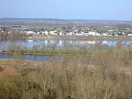 A general view of Villebernier | |
 Coat of arms | |
Location of Villebernier | |
 Villebernier 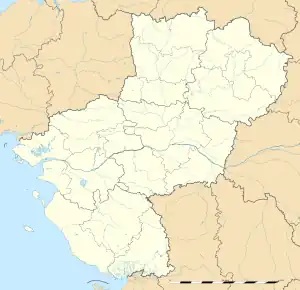 Villebernier | |
| Coordinates: 47°15′11″N 0°01′44″W / 47.253°N 0.029°W | |
| Country | France |
| Region | Pays de la Loire |
| Department | Maine-et-Loire |
| Arrondissement | Saumur |
| Canton | Longué-Jumelles |
| Intercommunality | CA Saumur Val de Loire |
| Government | |
| • Mayor (2020–2026) | Jean-François Miglierina[1] |
| Area 1 | 9.91 km2 (3.83 sq mi) |
| Population | 1,446 |
| • Density | 150/km2 (380/sq mi) |
| Time zone | UTC+01:00 (CET) |
| • Summer (DST) | UTC+02:00 (CEST) |
| INSEE/Postal code | 49374 /49400 |
| Elevation | 23–32 m (75–105 ft) (avg. 32 m or 105 ft) |
| 1 French Land Register data, which excludes lakes, ponds, glaciers > 1 km2 (0.386 sq mi or 247 acres) and river estuaries. | |
Villebernier (French pronunciation: [vilbɛʁnje] ⓘ) is a commune in the Maine-et-Loire department in western France. It is located on the Northern bank of the Loire river, between Angers and Tours.
A couple of architectural treasures can be found in the village. A Romanesque church and the manor of Launay was built by Roi René in 1414. The chapel Notre-Dame-des-Eaux, built in 1843 by priest Théar, has a unique round architecture.
In 2018, the village had 1464 inhabitants.[3]
See also
References
- ↑ "Répertoire national des élus: les maires" (in French). data.gouv.fr, Plateforme ouverte des données publiques françaises. 13 September 2022.
- ↑ "Populations légales 2021". The National Institute of Statistics and Economic Studies. 28 December 2023.
- ↑ "Villebernier". Insee. 2020.
Wikimedia Commons has media related to Villebernier.
This article is issued from Wikipedia. The text is licensed under Creative Commons - Attribution - Sharealike. Additional terms may apply for the media files.