| Withernwick | |
|---|---|
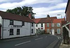 Main Street, Withernwick | |
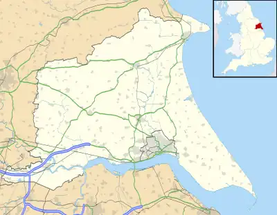 Withernwick Location within the East Riding of Yorkshire | |
| Population | 453 (2011 census)[1] |
| OS grid reference | TA195405 |
| Civil parish |
|
| Unitary authority | |
| Ceremonial county | |
| Region | |
| Country | England |
| Sovereign state | United Kingdom |
| Post town | HULL |
| Postcode district | HU11 |
| Dialling code | 01964 |
| Police | Humberside |
| Fire | Humberside |
| Ambulance | Yorkshire |
| UK Parliament | |
Withernwick is a village and civil parish in the East Riding of Yorkshire, England. It is situated approximately 10 miles (16 km) north-east of Hull city centre and 5 miles (8 km) south of Hornsea.
According to the 2011 UK census, Withernwick parish had a population of 453,[1] a reduction on the 2001 UK census figure of 474.[2]
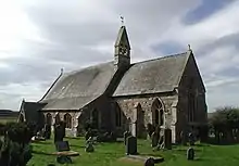
St Alban's Church
The parish church of St Alban is a Grade II listed building.[3]
Over the past few years the village has been in decline, having lost its post office, school, Methodist chapel and village hall.
References
- 1 2 UK Census (2011). "Local Area Report – Withernwick Parish (1170211290)". Nomis. Office for National Statistics. Retrieved 28 February 2018.
- ↑ UK Census (2001). "Local Area Report – Withernwick Parish (00FB161)". Nomis. Office for National Statistics. Retrieved 1 March 2020.
- ↑ Historic England. "Church of St Alban (1346630)". National Heritage List for England. Retrieved 7 February 2013.
- Gazetteer — A–Z of Towns Villages and Hamlets. East Riding of Yorkshire Council. 2006. p. 12.
External links
Wikimedia Commons has media related to Withernwick.
- Historic England. "St Alban's Church (1346630)". National Heritage List for England.
- Withernwick in the Domesday Book
- Withernwick information for visitors in Yorkshire.com
- Withernwick village website
| Unitary authorities | |
|---|---|
| Major settlements (cities in italics) | |
| Rivers | |
| Canals | |
| Topics | |
This article is issued from Wikipedia. The text is licensed under Creative Commons - Attribution - Sharealike. Additional terms may apply for the media files.