Yatma | |
|---|---|
| Arabic transcription(s) | |
| • Arabic | يتما |
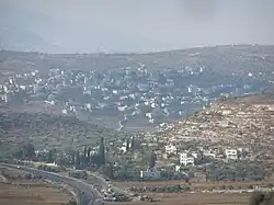 Yatma, 2012 | |
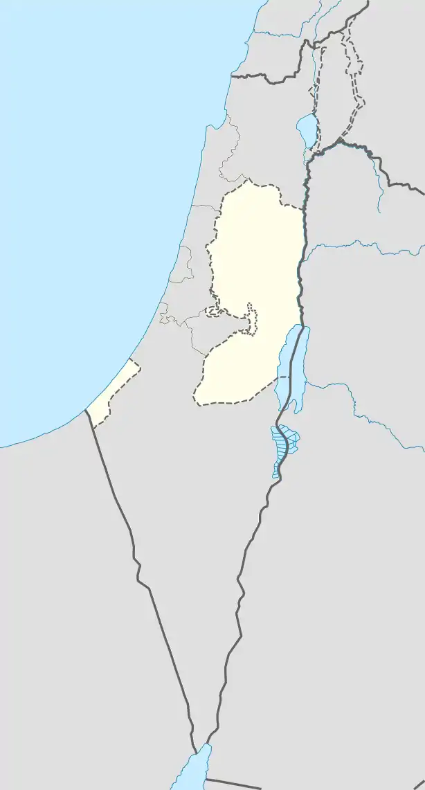 Yatma Location of Yatma within Palestine | |
| Coordinates: 32°06′30″N 35°16′06″E / 32.10833°N 35.26833°E | |
| Palestine grid | 175/168 |
| State | State of Palestine |
| Governorate | Nablus |
| Government | |
| • Type | Village council |
| Population (2017)[1] | |
| • Total | 3,363 |
| Name meaning | from Yetma, personal name[2] |
Yatma (Arabic: يتما) is a Palestinian town in the Nablus Governorate in northern West Bank, located 15 kilometers south of Nablus. According to the Palestinian Central Bureau of Statistics (PCBS), the town had a population of 3,363 inhabitants in 2017.[1]
Location
Yatma is located 12.4 km south of Nablus. It is bordered by Qabalan to the east and south, Beita to the north, Yasuf and As Sawiya to the west.[3]
History
Pottery sherds from the Iron Age II, Persian, Hellenistic/Roman and the Crusader/Ayyubid eras have been found here.[4]
It has been suggested that this was the place of origin of Dosthai of Kefar Iathma who is mentioned in the Mishnah as a disciple of the House of Shammai,[5][6] and that it was the Eincheitem of the Crusader period.[4]
Sherds from the Mamluk era has also been found here.[4]
Ottoman era
In 1517, the village was included in the Ottoman empire with the rest of Palestine, and in the 1596 tax-records it appeared as Yitma, located in the Nahiya of Jabal Qubal of the Liwa of Nablus. The population was 10 households and 2 bachelors, all Muslim. They paid a fixed tax rate of 33,3% on agricultural products, such as wheat, barley, summer crops, olive trees, goats and beehives, a press for olive oil or grape syrup, in addition to occasional revenues and a fixed tax for people of Nablus area; a total of 1,800 akçe.[7] Sherds from the early Ottoman era have also been found here.[4]
In 1838, Edward Robinson noted it as part of Jurat Merda District, south of Nablus.[8][9]
In 1850/1 de Saulcy noted Yatma on his travels in the region,[10] as did Victor Guérin in 1870.[11]
In 1870/1871 (1288 AH), an Ottoman census listed the village in the nahiya (sub-district) of Jamma'in al-Thani, subordinate to Nablus.[12]
In 1882, the Palestine Exploration Fund's Survey of Western Palestine Yetma was described as "A little village, on high ground, with olives round it."[13]
British Mandate era
In the 1922 census of Palestine conducted by the British Mandate authorities, Yatma had a population of 242 Muslims,[14] increasing in the 1931 census to 325 Muslims, in 64 houses.[15]
In the 1945 statistics the population was 440 Muslims[16] while the total land area was 3,777 dunams, according to an official land and population survey.[17] Of this, 1,214 dunams were used for plantations and irrigable land, 1,741 for cereals,[18] while 44 dunams were classified as built-up areas.[19]
Jordanian era
In the wake of the 1948 Arab–Israeli War, and after the 1949 Armistice Agreements, Yatma came under Jordanian rule.
The Jordanian census of 1961 found 618 inhabitants.[20]
Post 1967
Since the Six-Day War in 1967, Yatma has been under Israeli occupation.
After the 1995 accords, 29% of village land is defined as Area B land, while the remaining 71% is defined as Area C land. Israel has also confiscated village land for Israeli bypass roads.[21]
In 2011, two cars were set ablaze in Yatma and the village mosque was vandalised with Hebrew graffiti, reading "price tag" and "Migron", in what was assumed to be a price tag attack by Israeli settlers.[22][23]
References
- 1 2 Preliminary Results of the Population, Housing and Establishments Census, 2017 (PDF). Palestinian Central Bureau of Statistics (PCBS) (Report). State of Palestine. February 2018. pp. 64–82. Retrieved 2023-10-24.
- ↑ Palmer, 1881, p. 250
- ↑ Yatma Village Profile, ARIJ, p. 4
- 1 2 3 4 Finkelstein et al, 1997, p. 639
- ↑ Mishnah, Orlah, 2:5
- ↑ Neubauer, 1868, pp. 268-269
- ↑ Hütteroth and Abdulfattah, 1977, p. 136
- ↑ Robinson and Smith, 1841, vol. 3, Appendix 2, p. 127
- ↑ Robinson and Smith, 1841, vol. 3, p. 92
- ↑ Saulcy, 1854, vol 1, p. 103
- ↑ Guérin, 1875, p. 163
- ↑ Grossman, David (2004). Arab Demography and Early Jewish Settlement in Palestine. Jerusalem: Magnes Press. p. 252.
- ↑ Conder and Kitchener, 1882, SWP II, p. 287
- ↑ Barron, 1923, Table IX, p. 25
- ↑ Mills, 1932, p. 66
- ↑ Government of Palestine, Department of Statistics, 1945, p. 19
- ↑ Government of Palestine, Department of Statistics. Village Statistics, April, 1945. Quoted in Hadawi, 1970, p. 61
- ↑ Government of Palestine, Department of Statistics. Village Statistics, April, 1945. Quoted in Hadawi, 1970, p. 108
- ↑ Government of Palestine, Department of Statistics. Village Statistics, April, 1945. Quoted in Hadawi, 1970, p. 158
- ↑ Government of Jordan, Department of Statistics, 1964, p. 25
- ↑ Yatma Village Profile, ARIJ, pp. 15-17
- ↑ Second West Bank Mosque Vandalized, Settlers Blamed, 8 September 2011
- ↑ Quamar Mishirqi-Asad,'High ‘Price Tag’ in the Mosque of the Village Yatma,' in Rabbis for Human Rights, 13 September 2011. Archived September 3, 2012, at the Wayback Machine
Bibliography
- Barron, J.B., ed. (1923). Palestine: Report and General Abstracts of the Census of 1922. Government of Palestine.
- Conder, C.R.; Kitchener, H.H. (1882). The Survey of Western Palestine: Memoirs of the Topography, Orography, Hydrography, and Archaeology. Vol. 2. London: Committee of the Palestine Exploration Fund.
- Finkelstein, I.; Lederman, Zvi, eds. (1997). Highlands of many cultures. Tel Aviv: Institute of Archaeology of Tel Aviv University Publications Section. ISBN 965-440-007-3.
- Government of Jordan, Department of Statistics (1964). First Census of Population and Housing. Volume I: Final Tables; General Characteristics of the Population (PDF).
- Government of Palestine, Department of Statistics (1945). Village Statistics, April, 1945.
- Guérin, V. (1875). Description Géographique Historique et Archéologique de la Palestine (in French). Vol. 2: Samarie, pt. 2. Paris: L'Imprimerie Nationale.
- Hadawi, S. (1970). Village Statistics of 1945: A Classification of Land and Area ownership in Palestine. Palestine Liberation Organization Research Center.
- Hütteroth, Wolf-Dieter; Abdulfattah, Kamal (1977). Historical Geography of Palestine, Transjordan and Southern Syria in the Late 16th Century. Erlanger Geographische Arbeiten, Sonderband 5. Erlangen, Germany: Vorstand der Fränkischen Geographischen Gesellschaft. ISBN 3-920405-41-2.
- Mills, E., ed. (1932). Census of Palestine 1931. Population of Villages, Towns and Administrative Areas. Jerusalem: Government of Palestine.
- Neubauer, A. (1868). La géographie du Talmud : mémoire couronné par l'Académie des inscriptions et belles-lettres (in French). Paris: Lévy.
- Palmer, E.H. (1881). The Survey of Western Palestine: Arabic and English Name Lists Collected During the Survey by Lieutenants Conder and Kitchener, R. E. Transliterated and Explained by E.H. Palmer. Committee of the Palestine Exploration Fund.
- Robinson, E.; Smith, E. (1841). Biblical Researches in Palestine, Mount Sinai and Arabia Petraea: A Journal of Travels in the year 1838. Vol. 3. Boston: Crocker & Brewster.
- Saulcy, L.F. de (1854). Narrative of a journey round the Dead Sea, and in the Bible lands, in 1850 and 1851. Vol. 1, new edition. London: R. Bentley.
External links
- Welcome to Yatma
- Survey of Western Palestine, Map 14: IAA, Wikimedia commons
- Yatma Village Profile, Applied Research Institute–Jerusalem (ARIJ)
- Yatma, aerial photo, ARIJ
- Development Priorities and Needs in Yatma, ARIJ
