Aujan-Mournède | |
|---|---|
Location of Aujan-Mournède | |
 Aujan-Mournède 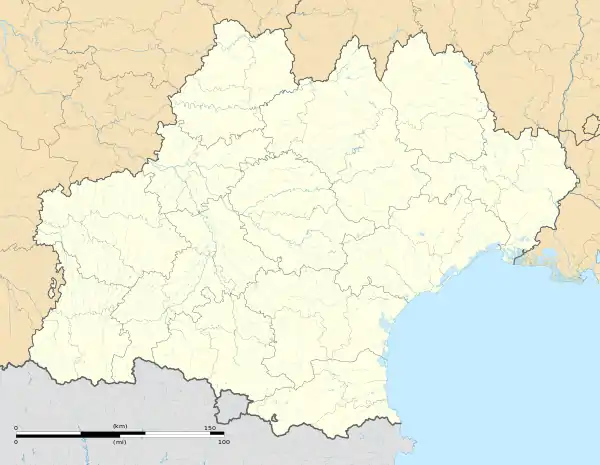 Aujan-Mournède | |
| Coordinates: 43°22′57″N 0°30′12″E / 43.3825°N 0.5033°E | |
| Country | France |
| Region | Occitania |
| Department | Gers |
| Arrondissement | Mirande |
| Canton | Astarac-Gimone |
| Intercommunality | CC Val Gers |
| Government | |
| • Mayor (2020–2026) | Florence Bordeneuve[1] |
| Area 1 | 8.46 km2 (3.27 sq mi) |
| Population | 90 |
| • Density | 11/km2 (28/sq mi) |
| Time zone | UTC+01:00 (CET) |
| • Summer (DST) | UTC+02:00 (CEST) |
| INSEE/Postal code | 32015 /32300 |
| Elevation | 217–370 m (712–1,214 ft) (avg. 250 m or 820 ft) |
| 1 French Land Register data, which excludes lakes, ponds, glaciers > 1 km2 (0.386 sq mi or 247 acres) and river estuaries. | |
Aujan-Mournède (French pronunciation: [oʒɑ̃ muʁnɛd]; Occitan: Aujan e Morneda) is a commune in the Gers department in southwestern France.
Geography
Localization
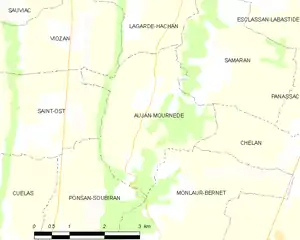
Aujan-Mournède and its surrounding communes
Hydrography
The Petite Baïse forms part of the commune's western border.
Population
| Year | Pop. | ±% |
|---|---|---|
| 1962 | 166 | — |
| 1968 | 144 | −13.3% |
| 1975 | 127 | −11.8% |
| 1982 | 117 | −7.9% |
| 1990 | 113 | −3.4% |
| 1999 | 107 | −5.3% |
| 2008 | 94 | −12.1% |
| 2015 | 90 | −4.3% |
See also
References
- ↑ "Répertoire national des élus: les maires" (in French). data.gouv.fr, Plateforme ouverte des données publiques françaises. 13 September 2022.
- ↑ "Populations légales 2021". The National Institute of Statistics and Economic Studies. 28 December 2023.
Wikimedia Commons has media related to Aujan-Mournède.
This article is issued from Wikipedia. The text is licensed under Creative Commons - Attribution - Sharealike. Additional terms may apply for the media files.