Deviat | |
|---|---|
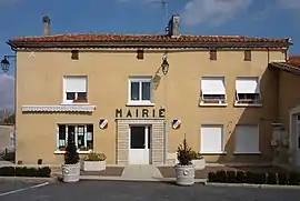 Town hall | |
Location of Deviat | |
 Deviat 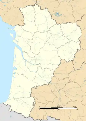 Deviat | |
| Coordinates: 45°25′07″N 0°00′35″E / 45.4186°N 0.0097°E | |
| Country | France |
| Region | Nouvelle-Aquitaine |
| Department | Charente |
| Arrondissement | Angoulême |
| Canton | Tude-et-Lavalette |
| Government | |
| • Mayor (2020–2026) | Jean-François Servant[1] |
| Area 1 | 8.42 km2 (3.25 sq mi) |
| Population | 133 |
| • Density | 16/km2 (41/sq mi) |
| Time zone | UTC+01:00 (CET) |
| • Summer (DST) | UTC+02:00 (CEST) |
| INSEE/Postal code | 16118 /16190 |
| Elevation | 74–167 m (243–548 ft) (avg. 135 m or 443 ft) |
| 1 French Land Register data, which excludes lakes, ponds, glaciers > 1 km2 (0.386 sq mi or 247 acres) and river estuaries. | |
Deviat (French pronunciation: [dəvja]) is a commune in the Charente department in southwestern France.
Population
| Year | Pop. | ±% p.a. |
|---|---|---|
| 1968 | 257 | — |
| 1975 | 230 | −1.57% |
| 1982 | 180 | −3.44% |
| 1990 | 156 | −1.77% |
| 1999 | 158 | +0.14% |
| 2009 | 167 | +0.56% |
| 2014 | 149 | −2.26% |
| 2020 | 135 | −1.63% |
| Source: INSEE[3] | ||
See also
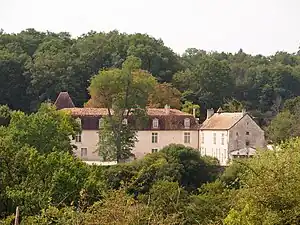
Château de la Faye
References
- ↑ "Répertoire national des élus: les maires". data.gouv.fr, Plateforme ouverte des données publiques françaises (in French). 9 August 2021.
- ↑ "Populations légales 2021". The National Institute of Statistics and Economic Studies. 28 December 2023.
- ↑ Population en historique depuis 1968, INSEE
Wikimedia Commons has media related to Deviat.
This article is issued from Wikipedia. The text is licensed under Creative Commons - Attribution - Sharealike. Additional terms may apply for the media files.