Herrin | |
|---|---|
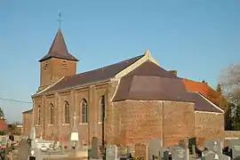 The church in Herrin | |
_Nord-France.svg.png.webp) Coat of arms | |
Location of Herrin | |
 Herrin 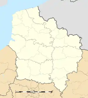 Herrin | |
| Coordinates: 50°32′50″N 2°57′58″E / 50.5472°N 2.9661°E | |
| Country | France |
| Region | Hauts-de-France |
| Department | Nord |
| Arrondissement | Lille |
| Canton | Faches-Thumesnil |
| Intercommunality | Pévèle-Carembault |
| Government | |
| • Mayor (2020–2026) | Marcel Procureur[1] |
| Area 1 | 2.17 km2 (0.84 sq mi) |
| Population | 423 |
| • Density | 190/km2 (500/sq mi) |
| Time zone | UTC+01:00 (CET) |
| • Summer (DST) | UTC+02:00 (CEST) |
| INSEE/Postal code | 59304 /59147 |
| Elevation | 18–27 m (59–89 ft) (avg. 25 m or 82 ft) |
| 1 French Land Register data, which excludes lakes, ponds, glaciers > 1 km2 (0.386 sq mi or 247 acres) and river estuaries. | |
Herrin (French pronunciation: [ɛʁɛ̃]) is a commune in the Nord department in northern France.[3]
Heraldry
Arms of Herrin |
The arms of Herrin are blazoned : Gules, a chief Or fretty sable.
|
See also
References
- ↑ "Répertoire national des élus: les maires". data.gouv.fr, Plateforme ouverte des données publiques françaises (in French). 2 December 2020.
- ↑ "Populations légales 2021". The National Institute of Statistics and Economic Studies. 28 December 2023.
- ↑ INSEE commune file
Wikimedia Commons has media related to Herrin (France).
This article is issued from Wikipedia. The text is licensed under Creative Commons - Attribution - Sharealike. Additional terms may apply for the media files.