Marcoing | |
|---|---|
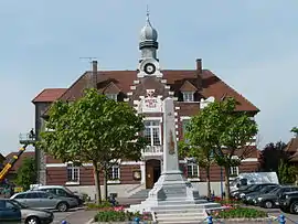 The town hall in Marcoing | |
_Nord-France.svg.png.webp) Coat of arms | |
Location of Marcoing | |
 Marcoing 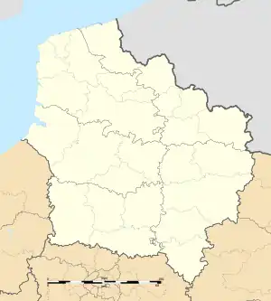 Marcoing | |
| Coordinates: 50°07′14″N 3°10′22″E / 50.1206°N 3.1728°E | |
| Country | France |
| Region | Hauts-de-France |
| Department | Nord |
| Arrondissement | Cambrai |
| Canton | Le Cateau-Cambrésis |
| Intercommunality | CA Cambrai |
| Government | |
| • Mayor (2020–2026) | Jean-Claude Guinet[1] |
| Area 1 | 15.11 km2 (5.83 sq mi) |
| Population | 1,888 |
| • Density | 120/km2 (320/sq mi) |
| Time zone | UTC+01:00 (CET) |
| • Summer (DST) | UTC+02:00 (CEST) |
| INSEE/Postal code | 59377 /59159 |
| Elevation | 51–127 m (167–417 ft) (avg. 64 m or 210 ft) |
| 1 French Land Register data, which excludes lakes, ponds, glaciers > 1 km2 (0.386 sq mi or 247 acres) and river estuaries. | |
Marcoing (French pronunciation: [maʁkwɛ̃]) is a commune in the Nord department in northern France.[3]
History
During World War I, there was an alleged incident between a British soldier named Henry Tandey and Adolf Hitler in this area. Hitler was unarmed and appeared wounded, so Tandey chose not to shoot and allowed him to walk-off unharmed.
From 1877 to 1969 Marcoing had a railway connection to Achiet-le-Grand via the Achiet–Marcoing railway. Later, a line to Cambrai opened.
Heraldry
Arms of Marcoing |
The arms of Marcoing are blazoned: Sable, fretty argent.
|
See also
References
- ↑ "Répertoire national des élus: les maires" (in French). data.gouv.fr, Plateforme ouverte des données publiques françaises. 13 September 2022.
- ↑ "Populations légales 2021". The National Institute of Statistics and Economic Studies. 28 December 2023.
- ↑ INSEE commune file
Wikimedia Commons has media related to Marcoing.
This article is issued from Wikipedia. The text is licensed under Creative Commons - Attribution - Sharealike. Additional terms may apply for the media files.