Parigny | |
|---|---|
Commune | |
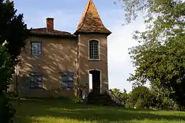 House of the Provost | |
.svg.png.webp) Coat of arms | |
Location of Parigny | |
 Parigny 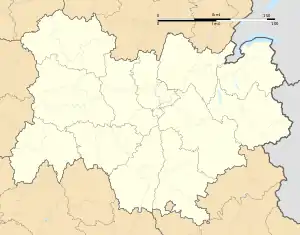 Parigny | |
| Coordinates: 45°59′29″N 4°05′53″E / 45.9914°N 4.0981°E | |
| Country | France |
| Region | Auvergne-Rhône-Alpes |
| Department | Loire |
| Arrondissement | Roanne |
| Canton | Le Coteau |
| Intercommunality | Roannais Agglomération |
| Government | |
| • Mayor (2020–2026) | Dominique Bruyère[1] |
| Area 1 | 9.15 km2 (3.53 sq mi) |
| Population | 628 |
| • Density | 69/km2 (180/sq mi) |
| Time zone | UTC+01:00 (CET) |
| • Summer (DST) | UTC+02:00 (CEST) |
| INSEE/Postal code | 42166 /42120 |
| Elevation | 277–446 m (909–1,463 ft) (avg. 331 m or 1,086 ft) |
| 1 French Land Register data, which excludes lakes, ponds, glaciers > 1 km2 (0.386 sq mi or 247 acres) and river estuaries. | |
Parigny (French pronunciation: [paʁiɲi]) is a commune in the Loire department in central France.
Population
| Year | Pop. | ±% p.a. |
|---|---|---|
| 1968 | 280 | — |
| 1975 | 372 | +4.14% |
| 1982 | 469 | +3.37% |
| 1990 | 503 | +0.88% |
| 1999 | 507 | +0.09% |
| 2009 | 597 | +1.65% |
| 2014 | 594 | −0.10% |
| 2020 | 631 | +1.01% |
| Source: INSEE[3] | ||
See also
References
- ↑ "Répertoire national des élus: les maires". data.gouv.fr, Plateforme ouverte des données publiques françaises (in French). 2 December 2020.
- ↑ "Populations légales 2021". The National Institute of Statistics and Economic Studies. 28 December 2023.
- ↑ Population en historique depuis 1968, INSEE
Wikimedia Commons has media related to Parigny (Loire).
This article is issued from Wikipedia. The text is licensed under Creative Commons - Attribution - Sharealike. Additional terms may apply for the media files.