Pertek District | |
|---|---|
 | |
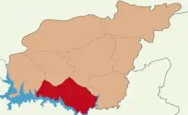 Map showing Pertek District in Tunceli Province | |
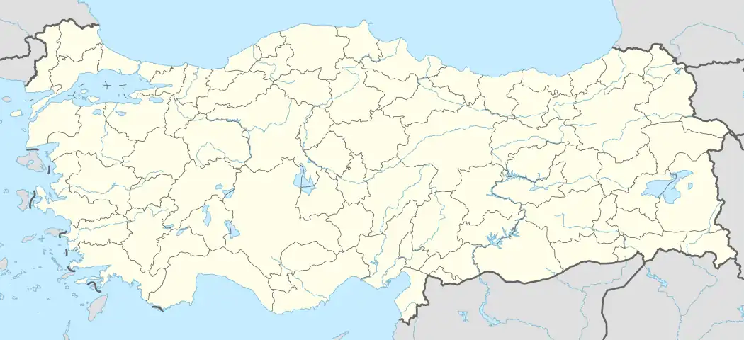 Pertek District Location in Turkey | |
| Coordinates: 38°52′N 39°20′E / 38.867°N 39.333°E | |
| Country | Turkey |
| Province | Tunceli |
| Seat | Pertek |
| Area | 858 km2 (331 sq mi) |
| Population (2021) | 11,011 |
| • Density | 13/km2 (33/sq mi) |
| Time zone | TRT (UTC+3) |
| Website | www |
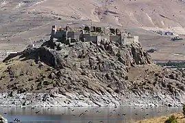
Pertek District is a district of Tunceli Province in Turkey. The town of Pertek is its seat and the district had a population of 11,011 in 2021.[1][2] Its area is 858 km2.[3] Kaymakam is Arif Gül.[4]
Composition
Beside the town of Pertek, the district encompasses forty-five villages and seventy-five hamlets.[1]
Villages
- Akdemir
- Ardıç
- Arpalı
- Aşağıgülbahçe
- Ayazpınar
- Bakırlı
- Ballıdut
- Beydamı
- Biçmekaya
- Bulgurtepe
- Çakırbahçe
- Çalıözü
- Çataksu
- Çukurca
- Demirsaban
- Dere
- Dereli
- Dorutay
- Elmakaşı
- Geçityaka
- Gövdeli
- Günboğazı
- Kacarlar
- Karagüney
- Kayabağ
- Kazılı
- Koçpınar
- Kolankaya
- Konaklar
- Konurat
- Korluca
- Mercimek
- Pınarlar
- Pirinççi
- Sağman
- Söğütlütepe
- Sumak
- Sürgüç
- Tozkoparan
- Ulupınar
- Yalınkaya
- Yamaçoba
- Yeniköy
- Yukarıgülbahçe
- Yukarıyakabaşı
References
- 1 2 "Türkiye Mülki İdare Bölümleri Envanteri". T.C. İçişleri Bakanlığı (in Turkish). Retrieved 19 December 2022.
- ↑ "31 ARALIK 2021 TARİHLİ ADRESE DAYALI NÜFUS KAYIT SİSTEMİ (ADNKS) SONUÇLARI" (XLS). TÜİK (in Turkish). Retrieved 16 December 2022.
- ↑ "İl ve İlçe Yüz ölçümleri". General Directorate of Mapping. Retrieved 1 March 2023.
- ↑ "Pertek Kaymakamı Arif GÜL". www.pertek.gov.tr. Retrieved 2019-12-06.
Pertek District in Tunceli Province of Turkey | |||||||||||||||||||||||||||
|---|---|---|---|---|---|---|---|---|---|---|---|---|---|---|---|---|---|---|---|---|---|---|---|---|---|---|---|
| Districts | 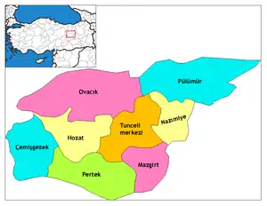 Districts of Tunceli | ||||||||||||||||||||||||||
| |||||||||||||||||||||||||||
Metropolitan municipalities are bolded. | |||||||||||||||||||||||||||
This article is issued from Wikipedia. The text is licensed under Creative Commons - Attribution - Sharealike. Additional terms may apply for the media files.