Pihem | |
|---|---|
_mairie.JPG.webp) The town hall of Pihem | |
 Coat of arms | |
Location of Pihem | |
 Pihem 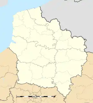 Pihem | |
| Coordinates: 50°41′02″N 2°12′50″E / 50.6839°N 2.2139°E | |
| Country | France |
| Region | Hauts-de-France |
| Department | Pas-de-Calais |
| Arrondissement | Saint-Omer |
| Canton | Lumbres |
| Intercommunality | Pays de Lumbres |
| Government | |
| • Mayor (2020–2026) | Jean-Claude Coyot[1] |
| Area 1 | 7.13 km2 (2.75 sq mi) |
| Population | 942 |
| • Density | 130/km2 (340/sq mi) |
| Time zone | UTC+01:00 (CET) |
| • Summer (DST) | UTC+02:00 (CEST) |
| INSEE/Postal code | 62656 /62570 |
| Elevation | 70–134 m (230–440 ft) (avg. 51 m or 167 ft) |
| 1 French Land Register data, which excludes lakes, ponds, glaciers > 1 km2 (0.386 sq mi or 247 acres) and river estuaries. | |
Pihem (French pronunciation: [pi.ɑ̃]) is a commune in the Pas-de-Calais department in the Hauts-de-France region of France.[3]
Geography
Pihem lies about 5 miles (8 km) south of Saint-Omer, on the D195 road.
Population
| Year | Pop. | ±% p.a. |
|---|---|---|
| 1968 | 532 | — |
| 1975 | 515 | −0.46% |
| 1982 | 616 | +2.59% |
| 1990 | 802 | +3.35% |
| 1999 | 893 | +1.20% |
| 2007 | 948 | +0.75% |
| 2012 | 996 | +0.99% |
| 2017 | 948 | −0.98% |
| Source: INSEE[4] | ||
Places of interest
- The church of St.Pierre, dating from the sixteenth century.
- The remains of a château.
See also
References
- ↑ "Répertoire national des élus: les maires". data.gouv.fr, Plateforme ouverte des données publiques françaises (in French). 2 December 2020.
- ↑ "Populations légales 2021". The National Institute of Statistics and Economic Studies. 28 December 2023.
- ↑ INSEE commune file
- ↑ Population en historique depuis 1968, INSEE
External links
Wikimedia Commons has media related to Pihem.
- A Pihem village website (in French)
This article is issued from Wikipedia. The text is licensed under Creative Commons - Attribution - Sharealike. Additional terms may apply for the media files.