Langeac | |
|---|---|
Commune | |
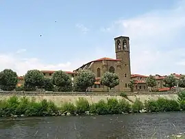 The river Allier and the Saint Gal Collegiate church. | |
 Coat of arms | |
Location of Langeac | |
 Langeac 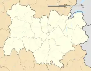 Langeac | |
| Coordinates: 45°06′04″N 3°29′42″E / 45.1011°N 3.495°E | |
| Country | France |
| Region | Auvergne-Rhône-Alpes |
| Department | Haute-Loire |
| Arrondissement | Brioude |
| Canton | Gorges de l'Allier-Gévaudan |
| Government | |
| • Mayor (2020–2026) | Gérard Beaud[1] |
| Area 1 | 33.94 km2 (13.10 sq mi) |
| Population | 3,437 |
| • Density | 100/km2 (260/sq mi) |
| Time zone | UTC+01:00 (CET) |
| • Summer (DST) | UTC+02:00 (CEST) |
| INSEE/Postal code | 43112 /43300 |
| Elevation | 488–951 m (1,601–3,120 ft) |
| 1 French Land Register data, which excludes lakes, ponds, glaciers > 1 km2 (0.386 sq mi or 247 acres) and river estuaries. | |
Langeac (French pronunciation: [lɑ̃ʒak]; Occitan: Lanjac) is a commune in the Haute-Loire department in south-central France. It is located about 30 km west of Le Puy-en-Velay, and about 100 km southwest of Lyon.
Population
|
| ||||||||||||||||||||||||||||||||||||||||||||||||||||||
| Source: EHESS[3] and INSEE (1968-2017)[4] | |||||||||||||||||||||||||||||||||||||||||||||||||||||||
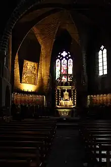
church interior
See also
References
- ↑ "Répertoire national des élus: les maires" (in French). data.gouv.fr, Plateforme ouverte des données publiques françaises. 13 September 2022.
- ↑ "Populations légales 2021". The National Institute of Statistics and Economic Studies. 28 December 2023.
- ↑ Des villages de Cassini aux communes d'aujourd'hui: Commune data sheet Langeac, EHESS (in French).
- ↑ Population en historique depuis 1968, INSEE
Wikimedia Commons has media related to Langeac.
This article is issued from Wikipedia. The text is licensed under Creative Commons - Attribution - Sharealike. Additional terms may apply for the media files.