Loreux | |
|---|---|
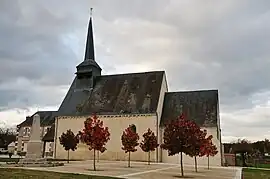 Church of Saint-Laurian | |
Location of Loreux | |
 Loreux 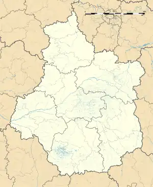 Loreux | |
| Coordinates: 47°23′59″N 1°49′54″E / 47.3997°N 1.8317°E | |
| Country | France |
| Region | Centre-Val de Loire |
| Department | Loir-et-Cher |
| Arrondissement | Romorantin-Lanthenay |
| Canton | Romorantin-Lanthenay |
| Intercommunality | Romorantinais et Monestois |
| Government | |
| • Mayor (2020–2026) | Joël Herisset[1] |
| Area 1 | 29.95 km2 (11.56 sq mi) |
| Population | 210 |
| • Density | 7.0/km2 (18/sq mi) |
| Time zone | UTC+01:00 (CET) |
| • Summer (DST) | UTC+02:00 (CEST) |
| INSEE/Postal code | 41118 /41200 |
| Elevation | 88–124 m (289–407 ft) |
| 1 French Land Register data, which excludes lakes, ponds, glaciers > 1 km2 (0.386 sq mi or 247 acres) and river estuaries. | |
Loreux (French pronunciation: [lɔʁø]) is a commune in the Loir-et-Cher department of central France.[3]
Population
| Year | Pop. | ±% p.a. |
|---|---|---|
| 1968 | 285 | — |
| 1975 | 247 | −2.02% |
| 1982 | 260 | +0.74% |
| 1990 | 265 | +0.24% |
| 1999 | 255 | −0.43% |
| 2007 | 247 | −0.40% |
| 2012 | 230 | −1.42% |
| 2017 | 209 | −1.90% |
| Source: INSEE[4] | ||
See also
References
- ↑ "Répertoire national des élus: les maires" (in French). data.gouv.fr, Plateforme ouverte des données publiques françaises. 13 September 2022.
- ↑ "Populations légales 2021". The National Institute of Statistics and Economic Studies. 28 December 2023.
- ↑ INSEE commune file
- ↑ Population en historique depuis 1968, INSEE
Wikimedia Commons has media related to Loreux.
This article is issued from Wikipedia. The text is licensed under Creative Commons - Attribution - Sharealike. Additional terms may apply for the media files.