Viriville | |
|---|---|
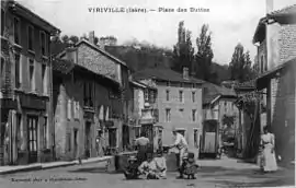 Viriville in 1912 | |
 Coat of arms | |
Location of Viriville | |
 Viriville 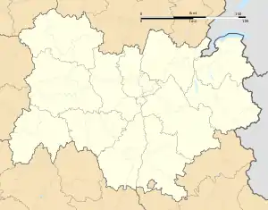 Viriville | |
| Coordinates: 45°19′00″N 5°12′18″E / 45.3167°N 5.205°E | |
| Country | France |
| Region | Auvergne-Rhône-Alpes |
| Department | Isère |
| Arrondissement | Vienne |
| Canton | Bièvre |
| Government | |
| • Mayor (2020–2026) | Françoise Sempé-Buffet[1] |
| Area 1 | 30.46 km2 (11.76 sq mi) |
| Population | 1,706 |
| • Density | 56/km2 (150/sq mi) |
| Time zone | UTC+01:00 (CET) |
| • Summer (DST) | UTC+02:00 (CEST) |
| INSEE/Postal code | 38561 /38980 |
| Elevation | 306–606 m (1,004–1,988 ft) (avg. 360 m or 1,180 ft) |
| 1 French Land Register data, which excludes lakes, ponds, glaciers > 1 km2 (0.386 sq mi or 247 acres) and river estuaries. | |
Viriville (French pronunciation: [viʁivil]) is a commune in the Isère department in southeastern France.[3]
Population
| Year | Pop. | ±% p.a. |
|---|---|---|
| 1968 | 1,101 | — |
| 1975 | 1,141 | +0.51% |
| 1982 | 1,137 | −0.05% |
| 1990 | 1,194 | +0.61% |
| 1999 | 1,176 | −0.17% |
| 2009 | 1,458 | +2.17% |
| 2014 | 1,634 | +2.31% |
| 2020 | 1,681 | +0.47% |
| Source: INSEE[4] | ||
See also
References
- ↑ "Répertoire national des élus: les maires". data.gouv.fr, Plateforme ouverte des données publiques françaises (in French). 9 August 2021.
- ↑ "Populations légales 2021". The National Institute of Statistics and Economic Studies. 28 December 2023.
- ↑ INSEE commune file
- ↑ Population en historique depuis 1968, INSEE
Wikimedia Commons has media related to Viriville.
This article is issued from Wikipedia. The text is licensed under Creative Commons - Attribution - Sharealike. Additional terms may apply for the media files.