Vourey | |
|---|---|
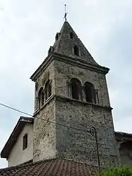 The bell tower of the church in Vourey | |
 Coat of arms | |
Location of Vourey | |
 Vourey 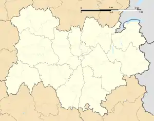 Vourey | |
| Coordinates: 45°19′18″N 5°31′14″E / 45.3217°N 5.5206°E | |
| Country | France |
| Region | Auvergne-Rhône-Alpes |
| Department | Isère |
| Arrondissement | Grenoble |
| Canton | Tullins |
| Intercommunality | Pays Voironnais |
| Government | |
| • Mayor (2020–2026) | Fabienne Blachot-Minassian[1] |
| Area 1 | 6.88 km2 (2.66 sq mi) |
| Population | 1,687 |
| • Density | 250/km2 (640/sq mi) |
| Time zone | UTC+01:00 (CET) |
| • Summer (DST) | UTC+02:00 (CEST) |
| INSEE/Postal code | 38566 /38210 |
| Elevation | 181–402 m (594–1,319 ft) (avg. 192 m or 630 ft) |
| 1 French Land Register data, which excludes lakes, ponds, glaciers > 1 km2 (0.386 sq mi or 247 acres) and river estuaries. | |
Vourey (French pronunciation: [vuʁɛ]) is a commune in the Isère department in southeastern France.[3]
Population
| Year | Pop. | ±% p.a. |
|---|---|---|
| 1968 | 672 | — |
| 1975 | 761 | +1.79% |
| 1982 | 1,033 | +4.46% |
| 1990 | 1,236 | +2.27% |
| 1999 | 1,548 | +2.53% |
| 2009 | 1,610 | +0.39% |
| 2014 | 1,677 | +0.82% |
| 2020 | 1,697 | +0.20% |
| Source: INSEE[4] | ||
See also
References
- ↑ "Répertoire national des élus: les maires". data.gouv.fr, Plateforme ouverte des données publiques françaises (in French). 2 December 2020.
- ↑ "Populations légales 2021". The National Institute of Statistics and Economic Studies. 28 December 2023.
- ↑ INSEE commune file
- ↑ Population en historique depuis 1968, INSEE
Wikimedia Commons has media related to Vourey.
This article is issued from Wikipedia. The text is licensed under Creative Commons - Attribution - Sharealike. Additional terms may apply for the media files.