Sulignat | |
|---|---|
Commune | |
 | |
Location of Sulignat | |
 Sulignat 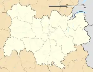 Sulignat | |
| Coordinates: 46°10′00″N 4°58′00″E / 46.1667°N 4.9667°E | |
| Country | France |
| Region | Auvergne-Rhône-Alpes |
| Department | Ain |
| Arrondissement | Bourg-en-Bresse |
| Canton | Châtillon-sur-Chalaronne |
| Government | |
| • Mayor (2020–2026) | Alain Genestoux[1] |
| Area 1 | 10.9 km2 (4.2 sq mi) |
| Population | 608 |
| • Density | 56/km2 (140/sq mi) |
| Time zone | UTC+01:00 (CET) |
| • Summer (DST) | UTC+02:00 (CEST) |
| INSEE/Postal code | 01412 /01400 |
| Elevation | 202–278 m (663–912 ft) (avg. 260 m or 850 ft) |
| 1 French Land Register data, which excludes lakes, ponds, glaciers > 1 km2 (0.386 sq mi or 247 acres) and river estuaries. | |
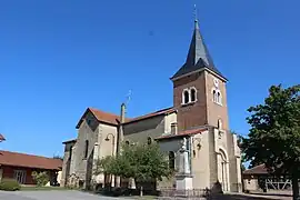
Sulignat (French pronunciation: [syliɲa]) is a commune in the Ain department in eastern France.
Population
| Year | Pop. | ±% p.a. |
|---|---|---|
| 1968 | 367 | — |
| 1975 | 348 | −0.76% |
| 1982 | 370 | +0.88% |
| 1990 | 434 | +2.01% |
| 1999 | 485 | +1.24% |
| 2009 | 575 | +1.72% |
| 2014 | 558 | −0.60% |
| 2020 | 611 | +1.52% |
| Source: INSEE[3] | ||
See also
References
- ↑ "Répertoire national des élus: les maires". data.gouv.fr, Plateforme ouverte des données publiques françaises (in French). 2 December 2020.
- ↑ "Populations légales 2021". The National Institute of Statistics and Economic Studies. 28 December 2023.
- ↑ Population en historique depuis 1968, INSEE
Wikimedia Commons has media related to Sulignat.
This article is issued from Wikipedia. The text is licensed under Creative Commons - Attribution - Sharealike. Additional terms may apply for the media files.